At the centre of the East Cantons (Prussian in 1815, Belgian in 1919, German between 1940 and 1945), Waimes is the only French-speaking commune in Belgium having a border with Germany (City of Montjoie/Monschau). It has had a turbulent history, sometimes painful, often surprising and nevertheless largely unknown.
The boundary stones, crosses, monuments and other relicts of the past, particularly present in the Fagnes, are the privileged witnesses.
As early as the 8th century BC (Hallstadt period), the Celts occupied the southern edge of the Fagnes: this presence is attested by the "tchèssions" (strongholds) erected on the slopes of the Warche (notably at Walk), but also by gold washing pits at the sources of the Warchenne at Faymonville and in the Amblève valley. These were discovered in 1895, triggering a gold rush that lasted for about twenty years.
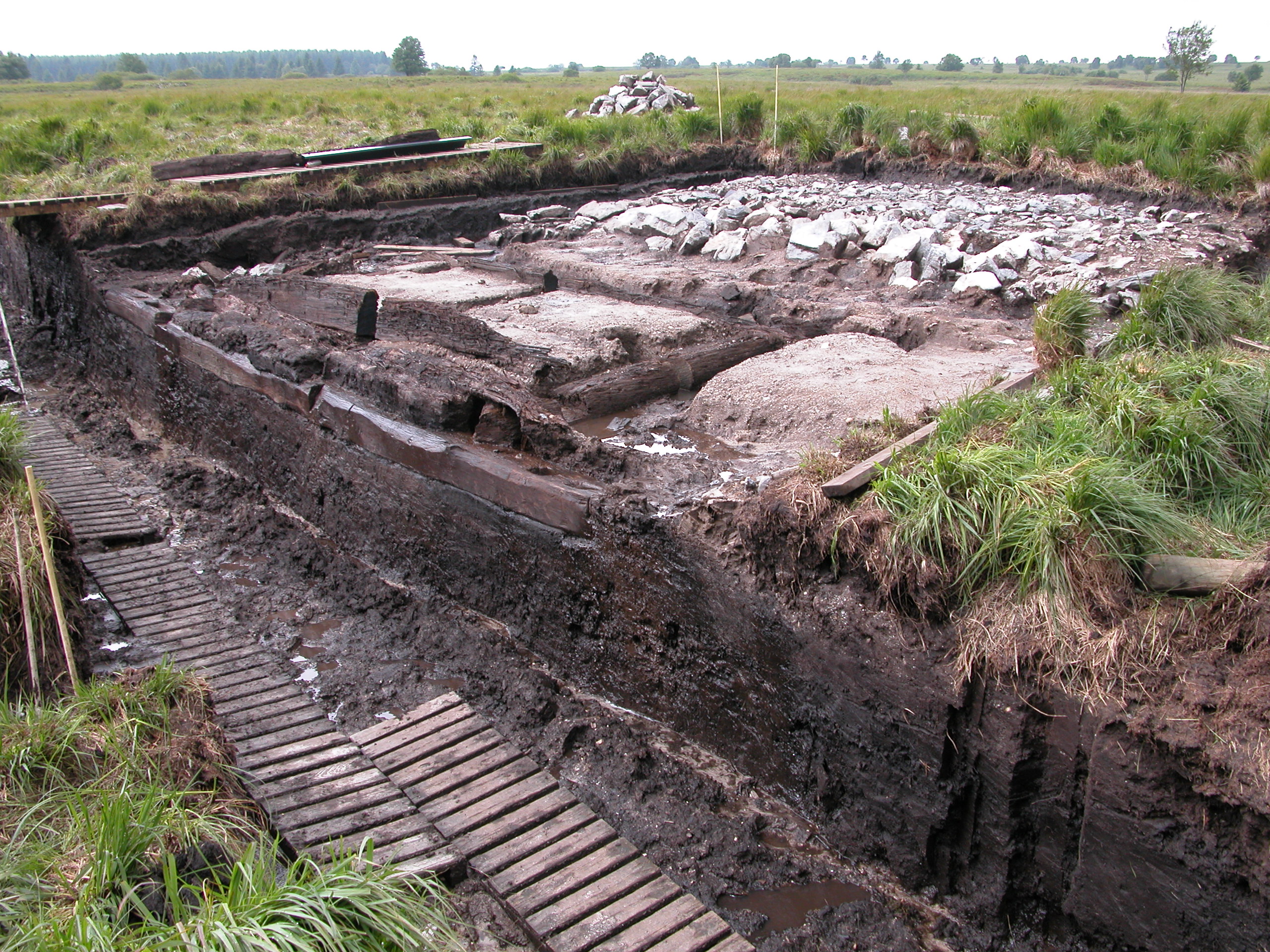
On the Fens plateau, the oldest trace of human presence is also the one that has given rise to the most questions and interpretations: the Via Mansuerisca (also known as the Charlemagne Pavement). Mentioned in 670 in a parchment of the Frankish king Childeric II, this path (6.5 km long), built on a wooden framework laid on the peat, formed for more than 1,000 years the boundary between the abbey principality of Stavelot-Malmedy (to which Waimes and its hamlets belonged, as well as Robertville and Ovifat) and the Dukedom of Luxembourg, to the east, with Faymonville and Sourbrodt (created later, in 1534). It was discovered under Maria Theresa of Austria in 1768, but it was the Abbé Bastin who in 1932 started to dig up at the point where it crossed the Helle, in the Fagne des Wez. More recently, on the basis of analyses of residues linked to the transport of lead ore, its construction could be dated to the end of the Roman Empire. Some scholars believe that it linked Maastricht to Trier and, failing to find a meaning for the adjective 'mansuerisca', see it as a wrong spelling of 'transuerisca' ('across the upper waters': from the Celtic 'warisca', giving 'Warche'); however, these attractive hypotheses are not validated by historians.
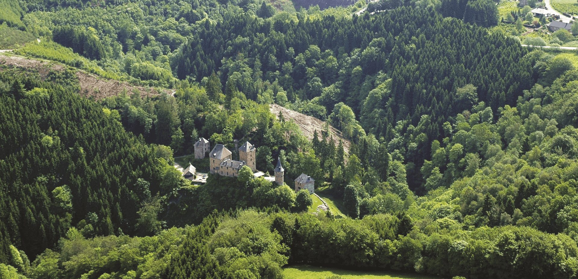
In 1354, Renaud de Waimes obtained the permission from the Duke of Luxembourg to build a castle on the eastern edge of the abbey principality. Standing on a rocky spur overlooking the Warche, Reinhardstein subsequently passed into the hands of several great families, including the Metternichs, who owned it until 1812. Destroyed by the troops of Louis XIV at the end of the 17th century, the Burg had fallen into ruins by then. It was rebuilt in 1969 on the initiative of Jean Overloop.
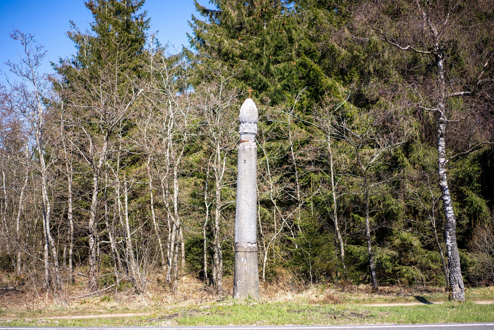
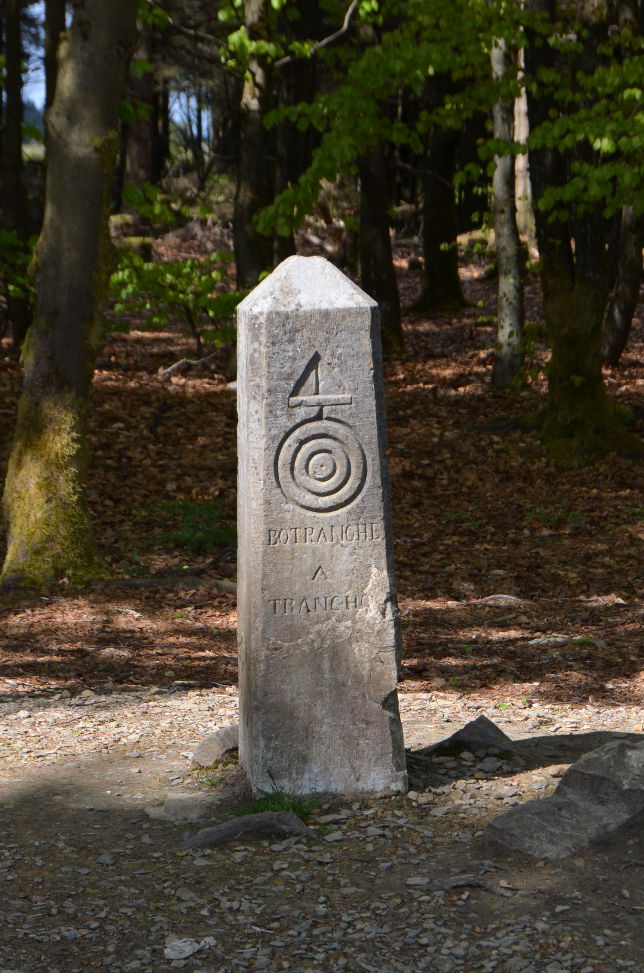
In 1560, three columns were erected in the Fens as landmarks for travellers crossing the Fens on the road from Limburg to Sourbrodt:
The 1st and 3rd columns bear inscriptions in Old French and Old German.
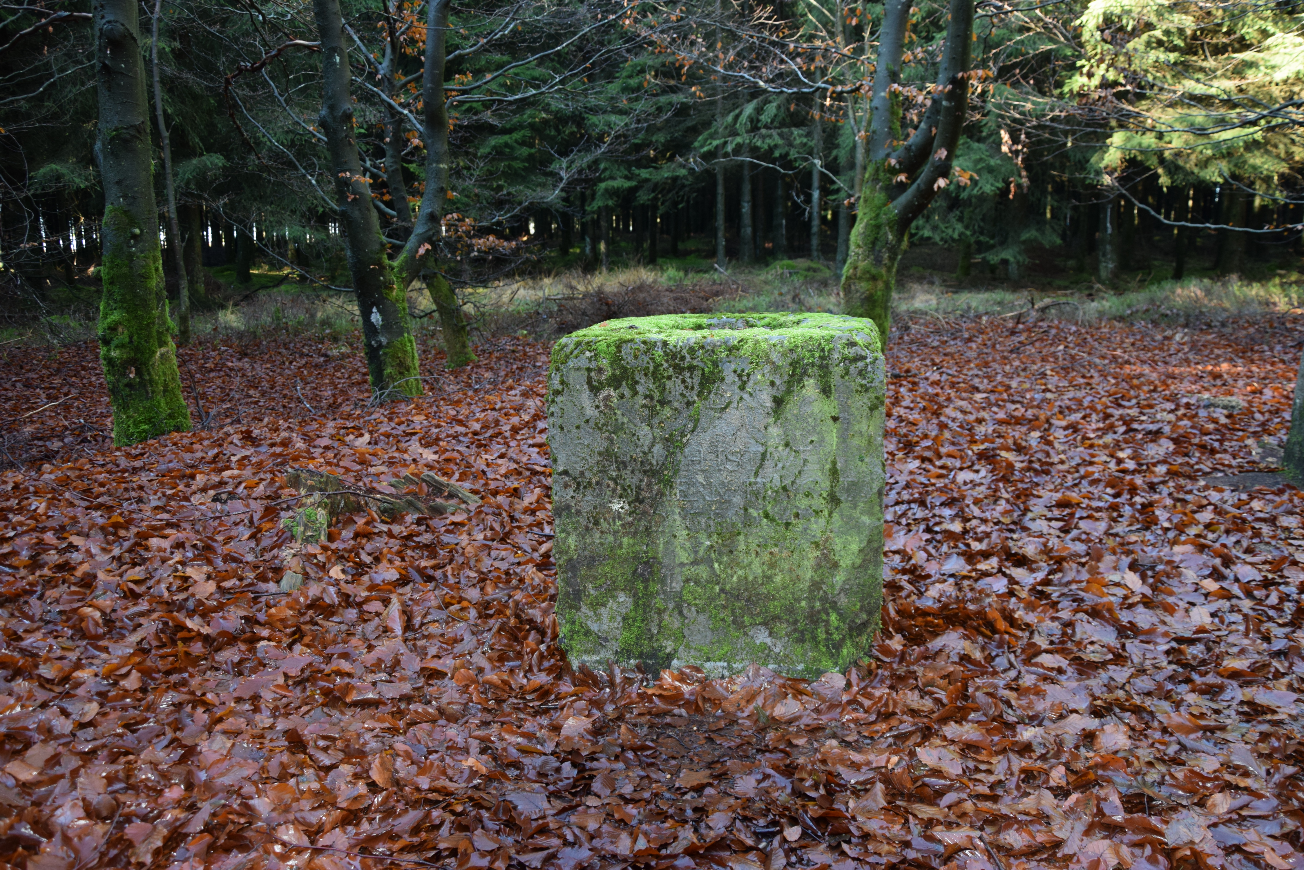
Under Maria Theresa of Austria, in 1756, the boundaries between Stavelot and Luxembourg were changed to the benefit of the Dukedom of Limburg. To mark these new borders, boundary markers were placed in the Fagnes (as well as one at the entrance to Faymonville), bearing the inscription STAV-LUX, or STAV-LIM or LIM-LUX. 150 metres north of the Signal de Botrange is the "Pierre à 3 coins"(Three-corner stone), which marks the intersection of these 3 territories.
At the end of the Ancien Régime, the old borders disappeared. From 1795 to 1814, the region was part of the French department of Ourthe. Under Napoleon, a military map was drawn up (using the triangulation method) by Colonel Tranchot, who erected a "Pyramid" (a geodesic marker marking a first-order trigonometric point) in Botrange.
In 1815, at the Congress of Vienna, the Kingdom of the Netherlands (including the future Belgium) was created, but the territory of the former Abbey Principality of Stavelot-Malmedy was split in two: the part of Malmedy (including Waimes) was assigned to Prussia, as well as the German-speaking parts of the Dukedom of Limburg (Eupen) and Luxembourg (St Vith). The border with the Netherlands is marked by a boundary marker(located along the Helle at the site of the Three- corner stone) with the inscription K(oningrijk) N(ederlands) - W(aimes) - B(utgenbach).
The Belgian Revolution of 1830 did not bring any change: like the German-speaking municipalities, Waimes (like Malmedy) remained Prussian. In 1839, 9 years after the independence of Belgium, the boundary between the two states was marked by B(elgium) - P(Russian) boundary markers: four of them are located between the Baraque Michel (B-P 154) and the site of the Three corner stone (B-P 157).
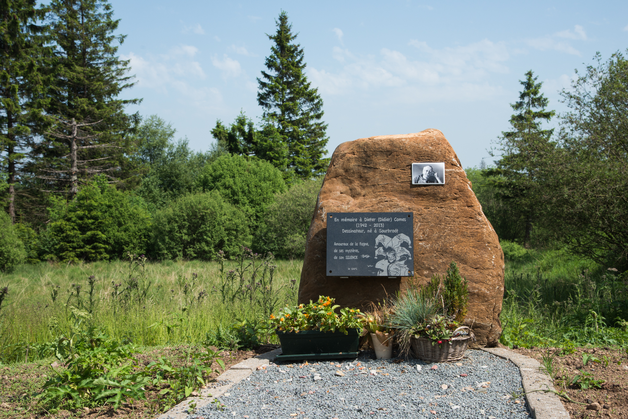
With Bismarck and the German reunification of 1871, the « Kulturkampf » imposed the German language, which generated a reaction from the Abbé Pietkin in Sourbrodt (defender of the Roman language and culture, to his memory a monument : Roman-wolf suckling Romulus and Remus was erected in 1927), then by the Abbé Bastin in Faymonville. In 1885, the construction of the Vennbahn began, a railway linking the Rothe Erde ironworks, near Aachen (Aix la Chapelle) to the Lorraine mining basin. A station was built in Waimes and Sourbrodt (as well as the nearby Elsenborn military camp), creating a new district. Comès, the famous strip cartoon writer ("Silence", "La Belette", "Eva", "Dix de der",...) was born there in 1942. After his death in 2013, a stele to his memory was erected at the entrance to the Fen, near the bridge over the Rour, at the end of the Rue de Bosfagne.
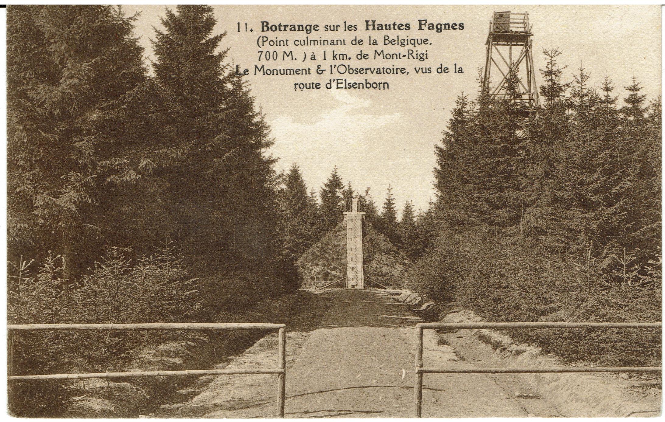
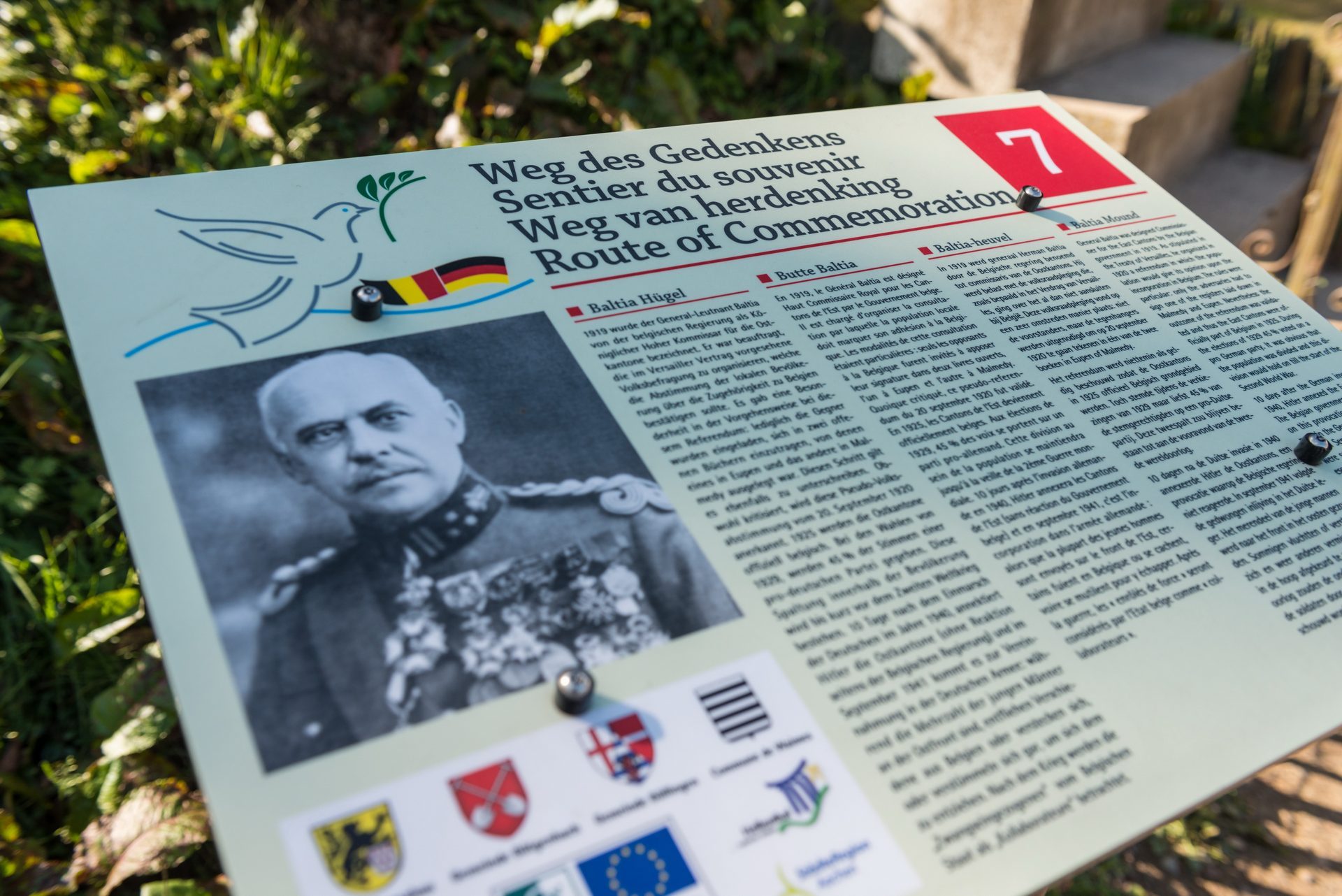
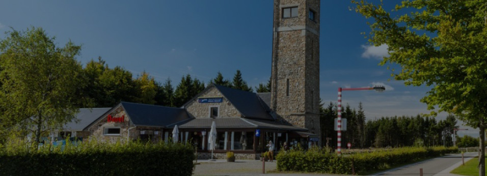
During the First World War, it was under the orders of the Kaiser that the local soldiers fought (on the Western Front, against France and Belgium, and on the Eastern Front, against the Russian Empire). In 1919, at the Treaty of Versailles, as compensation for the damage suffered during the First World War, Belgium obtained the former Kreis of Eupen - Malmedy, the so-called East Cantons, as well as the Vennbahn (including on German territory). As a result, almost all of the Fens were given to Belgium, whose highest point, which had previously been at Baraque Michel (672 m), was moved 3 km south-eastwards to Botrange, to reach 694 m. A 6-meter high mound, symbolically marking the 700-meter altitude, was erected there in 1923 by General Baltia, the Belgian government's High Commissioner for the East Cantons, to "signal" this new point (the present tower was built there in 1934). Forest areas belonging to the town of Montjoie also became Belgian and are now part of the municipal territory of Waimes: in the middle of these, out of nowhere, on its rocky ridge, stands a 6-meter high cross erected in 1890 by Abbot Arnoldy, parish priest of the German village of Kalterherberg: "Kreuz im Venn".
However, a referendum had to make sure that the local population would accept their new homeland. Fearing that the result would not be favourable, the Belgian delegation in Versailles adapted the consultation: Article 34 of the Treaty provided for two books to be opened (in Eupen and Malmedy), in which the opponents had to register. Organised in 1920 by General Baltia, this pseudo-referendum did not attract much participation, but was validated by the League of Nations. After Baltia's transition regime, which ended in 1925, a pro-German party was created; until the 1939 elections, it won each time, collecting between 43% and 48% of the votes. Hence it was a very divided local population that was plunged into the Second World War.
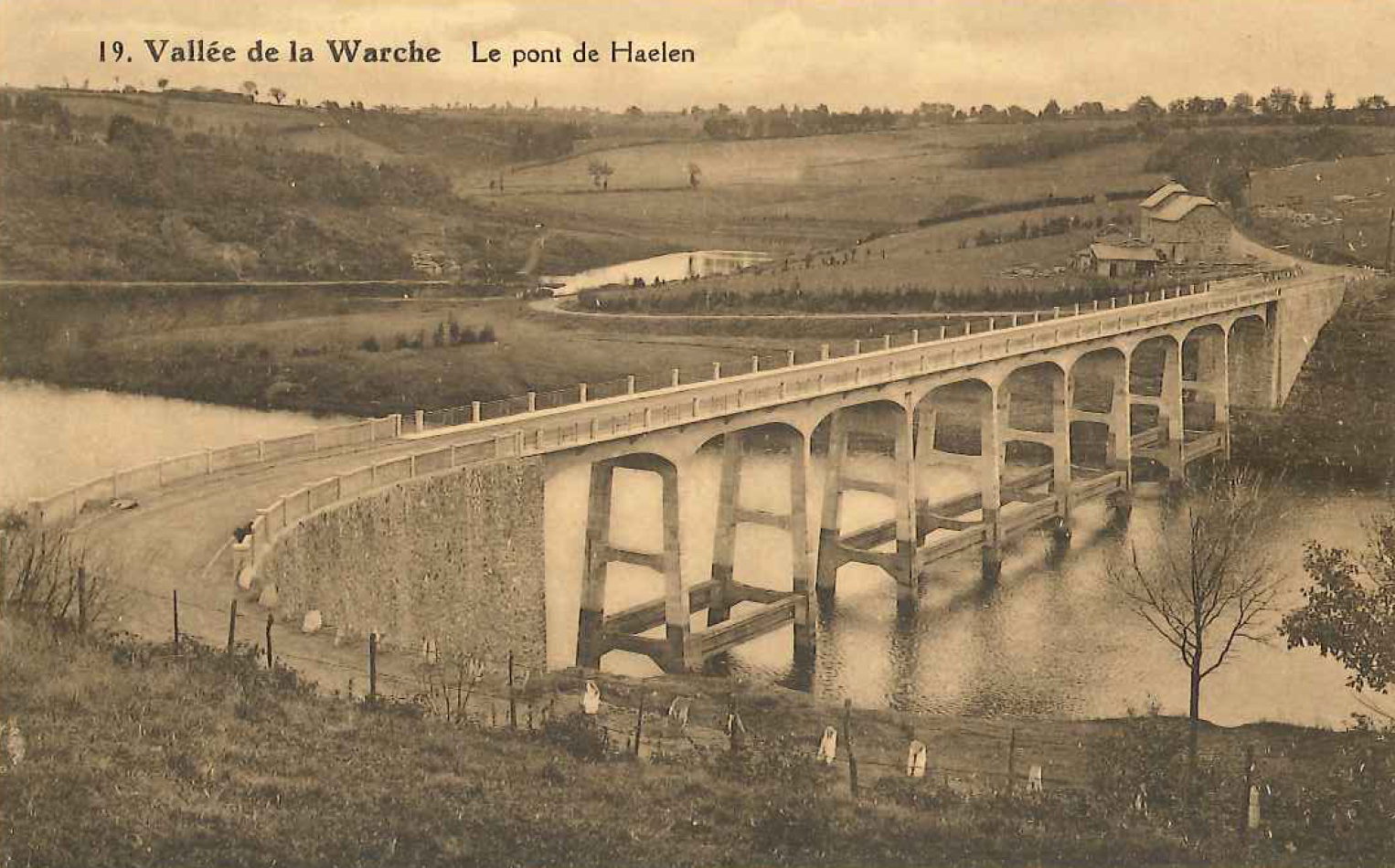
In the meantime, on Baltia's initiative, a dam was built between 1925 and 1928 on the Warche at Robertville (a second one was built a few years later at Butgenbach). In the process, the road that crossed the river was swallowed up by the water. Replacing the bridge over the Warche, which dated from the Prussian period and was called the "Waterloo Bridge", a new bridge over the lake was created; it was renamed the "Haelen Bridge" (a town near Diest, where the Belgian army repelled the German advance in 1914).
In 1940, on 18 May, even before the capitulation of Belgium, Hitler annexed the Eastern Cantons to the Third Reich, without any reaction from the Belgian government. On 21 September 1941, German nationality was imposed on the population, leading to the enlistment of men aged 18 and over into the Wehrmacht (8,000 in total, most of whom were sent to the East Front, of whom 3,200 did not return). In 1945, the population of the East Cantons was subject to a general repression for uncivil behaviour (more than 15,000 files were opened) by the Belgian state, which made no distinction between occupied and annexed territory. Although most of the prosecutions were dropped, the inhabitants of the East Cantons were for a long time perceived as collaborators, or even called 'Krauts', by the population of the inland.
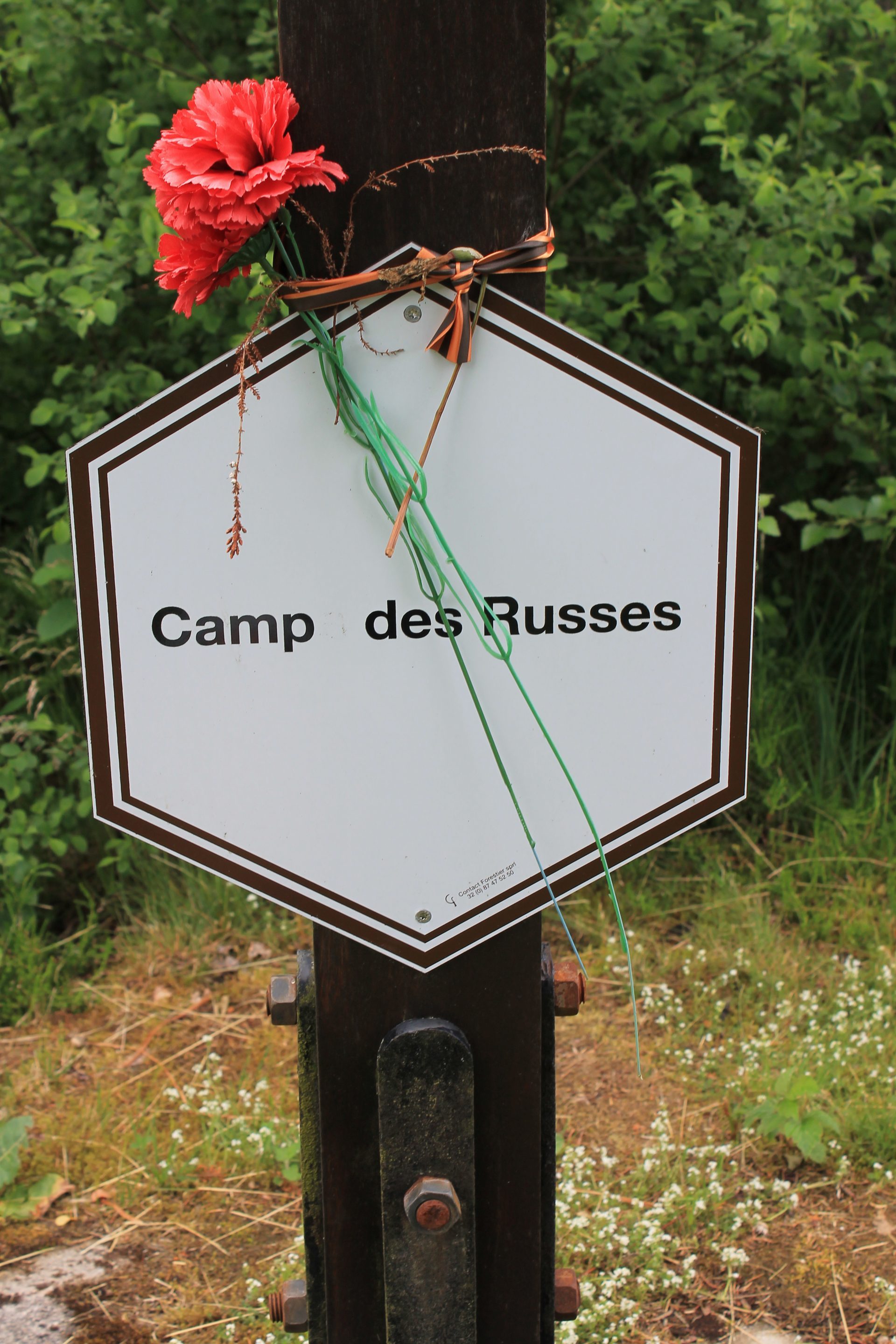
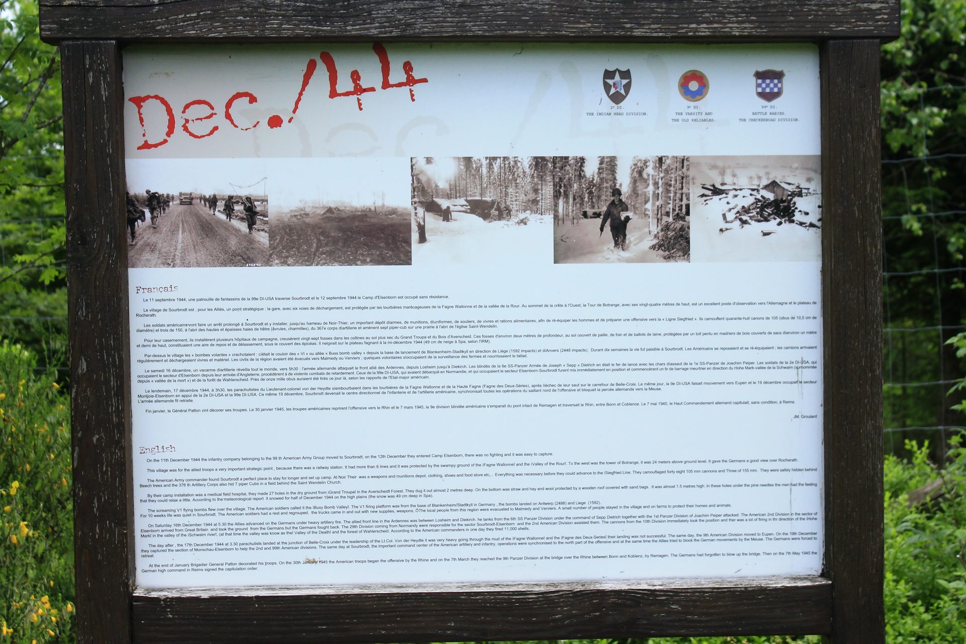
In 1943, a camp for Red Army soldiers taken prisoner by the Wehrmacht was built at the entrance to the Fen in Sourbrodt. It is commemorated by the Russian Cross, erected on this place. In December 1944, the Battle of the Bulge (also known as the von Rundstedt Offensive) raged: on its northern flank, the American artillery deployed around the Elsenborn camp (notably in Sourbrodt) bombarded the German troops constantly, pushing them back into the Amblève valley and stopping their advance towards Liège and Antwerp, causing the failure of this offensive. Caught under fire, several villages in the south of the Fens (in particular Faymonville) were destroyed, causing the death or flight of their inhabitants.
The post-war period was particularly painful, both materially and morally.
In 2015, following the publication of the book "Nos terres volées en 1940" (Our lands stolen in 1940) by Paul Dandrifosse, the municipality of Waimes erected a monument called the "Botrange Manifesto", symbolically placed at the foot of the Butte Baltia, pleading for an official recognition by Belgium of this dark page of its history.


Find here all the news and important information for the tourism in Waimes !